An assessment of Elevated Riparian Optimization (ERO) structures on the South Fork of the Kinni, Hay Creek, and Cady Creek, 5-years post installation
By Loren Haas
Hungry water is copious amounts of water not heavily laden with silt which provides extra energy and carrying capacity for sand and silt. Typically occurring in the spring, frozen soil helps minimize runoff erosion. Heavy snow accumulation and a late thaw made for one of the best spring scouring events in recent years.
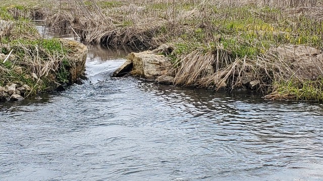
Flooding on the South Fork of the Kinni this spring has flushed out the sand below each of the EROs. Last year’s partial deposition is gone and the deep holes are looking much deeper and longer than ever. All of the EROs except one produced fish. One ERO that has a flat rock wedged in between the anchor rocks provides narrowing high velocity and redirected water and has accidentally produced my favorite spot on the creek to catch fish.
Additionally, 3 more lunker structures have been partially exposed for the first time in many years. One is below an ERO, the others are upstream of the other 9 EROs. I expect this condition to be temporary as summer rains bring more sediment from upstream and rebury them. We will see. Pocket water sixteen inches deep or more has reappeared upstream of the EROs. It is still impossible to cast due to all the willows, but If you were to drop a fly into the pockets there are fish holding in the deeper areas.
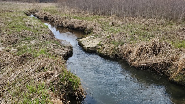
There are large sections of prairie that are apparently free of any willows! Some areas contain willows on one side of the creek while the other sections are totally infested with willows. Unfortunately, the areas closest to the creek still have a major willow problem.
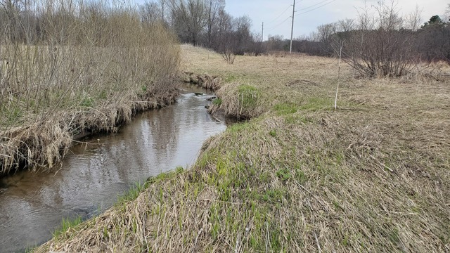
Hay creek has 4 of the 5 Eros still producing deep enough water to hold trout. Only the #1 structure closest to the bridge is deep enough to hold nice sized fish. Two of the previous deep corners that held fish have filled in with sand and are devoid of fish. Pocket water does exist between the EROs but it lacks adequate depth or cover and seems to lack fish. Perhaps additional efforts such as adding a rocky substrate and additional structures could lead to more bank stabilization and subsequent undercuts that may attract trout.
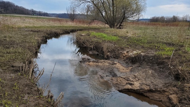
Cady creek, what a gem. While some areas still remain dominated by sand, many areas have flushed clean and provide pocket water up to 45 inches deep. From the snowmobile bridge upstream, the #1 ERO is still plagued by rock washed into the downstream side of the ERO. It won’t provide deep water until the rock is removed. We did remove the rock upstream last fall which allowed scouring to occur and the ERO went from 85% full to 50% full under normal water levels. With that said, there is deep water and trout in the bend due to natural snags and rock causing the water to rise over and cut deep water below the snags. The #2 ERO provided stable 4 feet deep water 55 feet downstream. That number has increased by 5 to 10 feet, but this might be temporary. The #3 ERO deep hole is HUGE! Over my waders and maybe over my head with an additional 10 feet of length of 3-foot-deep water added. In a previous report I stated, this is the strongest and best ERO ever built, but wow I was shocked. Too many spooked trout to count.
I visited Halverson horse ranch to check on the scouring. It’s amazing and far better than after it was just finished. Enough said.
From my perspective the ERO’s constructed over the last 5 years have done a good job of creating deep runs. These deep runs provide habitat and cover for mature fish and are an important component of a healthy fishery.
ERO Structures Number and Location:
Hay Creek, 5
Plum Creek, 2, uninspected this year
South Fork Kinni, 9
Cady Creek, 3
Trimbelle Halverson easement, 2, uninspected this year
Trimbelle Thom easement, 1 or maybe 2, uninspected this year
Gilbert Creek in Dunn County, 10 or more and still being built
Loren Notes that the construction of ERO structures by the Wisconsin DNR is a “very good sign of things to come.”
Loren Haas
May 8, 2023