Trimbelle River
Wisconsin designated exceptional resource water.The River
The Trimbelle River is located 36 miles southeast of St. Paul, Minnesota, a major metropolitan area of over 2 million people. The headwaters of Trimbelle River originate 6 miles east of River Falls in Pierce County, WI, flowing for 20 miles before discharging into the Mississippi River at the Trenton Slough.
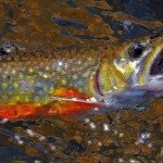
Year-round flow in the Trimbelle River begins with a group of cold-water springs in northern Pierce County, Wisconsin. The entire length below the springs is designated by the state of Wisconsin as Exceptional Resource Water and as a Class II trout stream. Twenty-one miles south and 300 feet lower elevation it discharges into the Mississippi and Lake Pepin. Much of the headwaters / cold spring area is permanently protected from development because it is owned by government entities including the U.S. Army Corps of Engineers, the Wisconsin DNR, and the Wisconsin DOT. Much of the stream bed is sandy, but with a gravel substrate. It courses alternately through wooded reaches and open farmland. The land is privately owned with two well-marked stretches that have fishing easements and that were the subject of habitat improvement projects in past years.
Kiap-TU-Wish Restoration on the Trimbelle:
With each high water event, the river banks would erode and cover the bottom and the springs with sand and silt, smothering insects and spawning habitat. As the banks eroded, the stream was becoming wider, shallower, and slower. In one place it was beginning to braid. On top of the banks grew many box elder trees. This species is very invasive especially along streams that flow through former agricultural land. They have weak root systems that do not hold soil well, and create a dense canopy that prevents sunlight from reaching the ground to allow more desirable species of plants to grow.
With help from the Wisconsin DNR, several sections of the Trimbelle were identified as potential areas for stream and riparian corridor restoration:
1. Pierce County Park below WI State Highway 10
2. Headwaters of the Trimbelle at Pierce County Highway W near Beldenville
3. Tire removal upstream of 570th Street Road near Beldenville
 Trimbelle Restoration at Highway W:

The Trimbelle River restoration at Highway W started as a “Bring Back the Natives” project, an initiative to reintroduce the once native Brook Trout to the stream. Over the decades, deforestation and poor agricultural practice had severely eroded the stream habitat in the project area. Bank erosion and sedimentation into the river had led to higher water temperature and slower stream flow. Once teeming with wild native brook trout trout, the river had become seriously impaired by sand and silt that washed down from agricultural fields a century ago.
Pierce County Trimbelle Recreation Area at State Highway 10
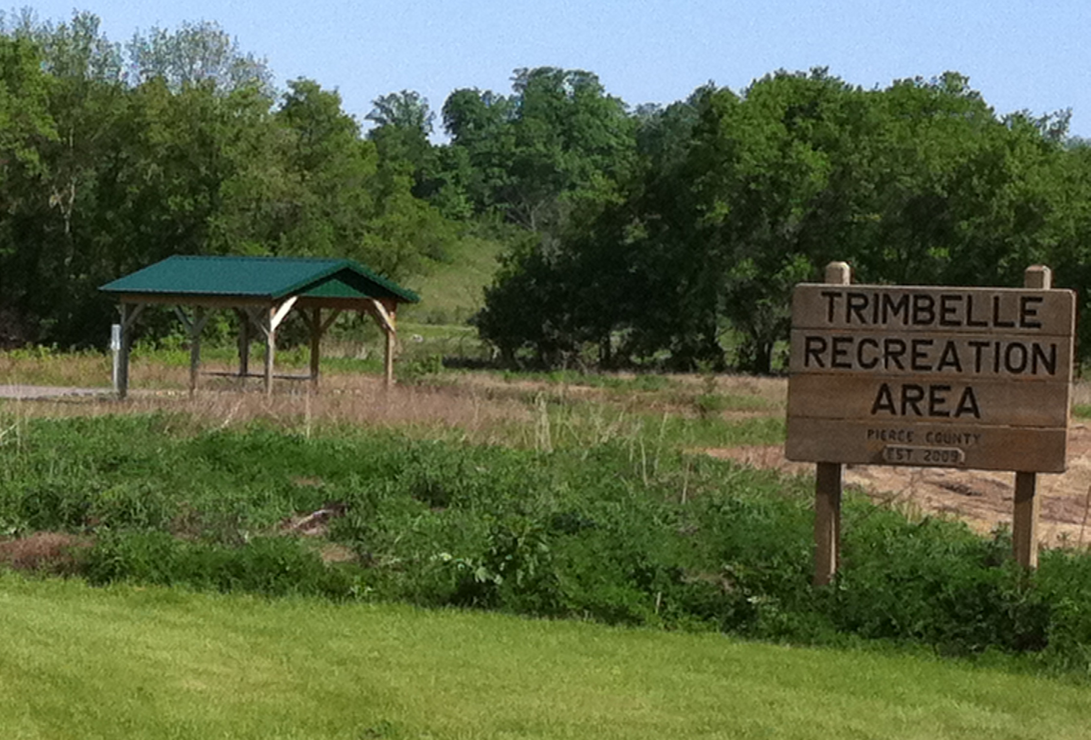 During 2012, a Kiap-TU-Wish did a restoration project in conjunction with the Pierce County Land Conservation Department, Pierce County Parks Department, and the Wisconsin Department of Natural Resources. The project restored nearly 1,000 feet of stream habitat for trout and other aquatic species in the project area, and connected two previous habitat restoration projects completed in 2000 and 2007 above and below the project site.
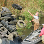 Trimbelle River Tire Clean-up
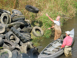
In 2011, eleven volunteers, working under the direction of Area Fisheries Manager Marty Engel and Barbara Scott of the Wisconsin Department of Natural Resources (DNR), remove waste tires from the Trimbelle River. Volunteers from Kiap-TU-Wish and others removed another over 2 tons of tires from the river.