Additional Benefits of a Trout Habitat Project
By Nate Anderson WDNR
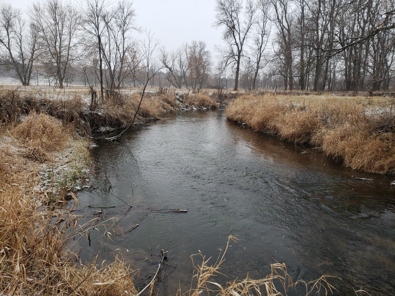
When most people think of a typical trout habitat project, they think about increasing trout numbers and having an easy place to fish. Another goal of a trout habitat project is to reduce streambank erosion. Historically, agricultural soil erosion from fields led to heavy deposition of fine sediment in streambeds. Excessive bank erosion in wooded and heavily pastured areas continues today. Generally, bank erosion rates are excessive when overhanging vegetation dominates the top of the bank, trees fall into the stream annually, or soil slips and slumps are common. Excessive bank erosion (lateral instability or widening) and downcutting are indicators of unstable streams. Excessive sediment deposition in a stream (formation of central bars or a braided stream) is also an indicator of instability.
Sedimentation of streams results in the loss of deep-water fish habitat and declines in spawning habitat and stream productivity. “Streambank erosion has long been identified as having negative impacts to water quality. The U.S. Environmental Protection Agency lists excessive sediments as a leading problem in our nation’s rivers and streams. Unnatural quantities of sediment entering streams can degrade aquatic habitat and alter physical and chemical characteristics of the water. Nutrients associated with soil particles enter the stream and become available to aquatic plants and algae, ultimately contributing to eutrophication of local and downstream waters.” (Pierce County Land and Water Management Plan. August 2021).
Erosion of streambanks is a naturally occurring process for many waterways, but impacts from humans such as removal of vegetation, foot/vehicle traffic, and channel modifications can exacerbate erosion. Conservation practices such as stream bank restoration, rotational grazing, fencing and buffer strips can be taken to reduce active bank erosion and reduce the impact of fine sediment to streams.
In a recent meeting with Pierce County Land and Water, KiapTUwish and WDNR, Rod Webb shared a formula to calculate how much soil loss is happening each year on local sites.
Eroding Bank Length X Eroding Bank Height X Lateral Recession Rate (FT/YR) X Soil Weight(lbs./ft3)/2000 = Estimated Soil Loss Per Year
Let’s use the latest project on the Trimbelle River-Thom easement using the formula. We did 4,000 feet of integrated bank treatment and the average height of the banks were 7 feet. Lateral Recession Rate for this section of stream is in the severe category with a .4 value due to banks that are bare with rills and contain severe vegetative overhang. Many exposed tree roots and some fallen trees and slumps or slips are present as well. The channel cross section becomes U-shaped as opposed to V-shape. Soil Weight has a 95 value with the Silty Clay Loam texture.
4,000 ft X 7 ft X .4 ft/yr X 95 lbs/ft3 / 2000 = 532 tons per year or 24 quad axle dump trucks of soil are lost each year from streambank erosion within the project site alone!!!
Phosphorus is also reduced by .2 pounds per ton of sediment. With this completed project, we are reducing phosphorus by 106 pounds per year just from within the project area.
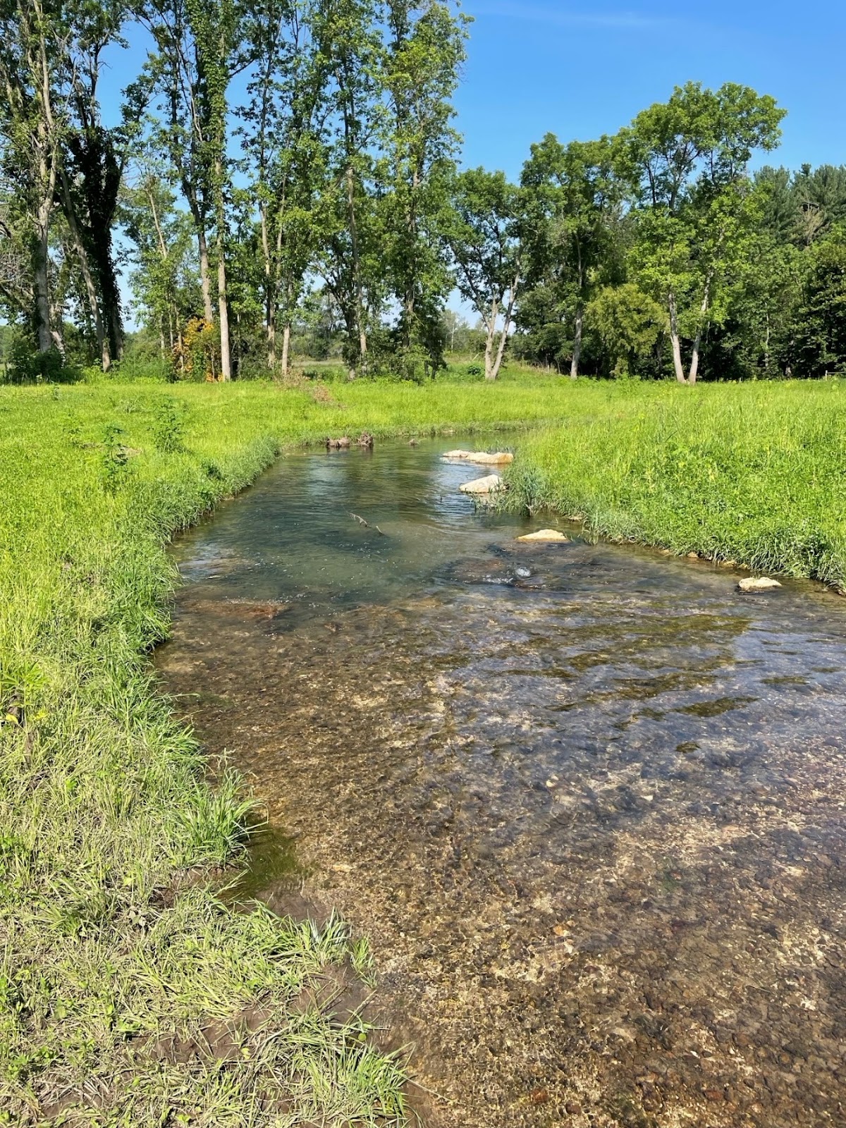
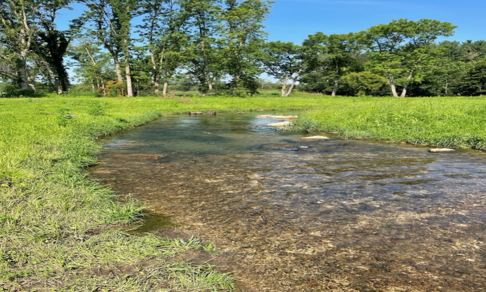
Once a project is completed, soil erosion is very limited if not eliminated. Rock protects the bank, the grass covering the rock prevents any future erosion and by sloping the banks to a more gradual slope, lessens the pressure on the banks while allowing the stream to reach its floodplain more easily.
“WDNR records show that Pierce County trout streams have improved substantially during the past 40 years due in part to projects like the Thom easement project and the improved farming practices taking place. In 1980, Pierce County had 17 trout streams for a total of 97 miles. By 2002, there were 47 trout streams for a total of 159 miles and Class I trout streams increased from 11 miles to 47.7 miles and Class II streams increased from 55 miles to 108 miles. The most recent information from Wisconsin DNR, shows 109 miles of Class I trout streams and 95 miles of Class II trout streams in the area.” (Pierce County Land and Water Management Plan. August 2021).
The two photos shown below are the same outside streambank, before the project started and a few months after the project was completed. It not only has habitat for trout and easier to fish, but it’s not allowing any fine sediment to reach the stream, now, and into the future.